
Norway Maps: Road, Tourist & Elevation (Free PDF/JPG)
Planning a road trip in Norway? Below you’ll find four downloadable maps that make route planning simple: a general map showing counties and major cities, a detailed road map, a tourist attractions map, and an elevation/relief map. Each one is available in JPG and PDF so you can print, zoom, or keep it offline on your phone.
Don’t have your car yet? Book with our car rental comparison to see live local offers and exclusive discounts. As a Norway-focused comparator, we aggregate the best deals so you can pick up the right vehicle and hit the road with confidence.
TABLE OF CONTENTS
- 1. General Map of Norway (Counties, Cities & Main Roads)
- 2. Norway Road Map
- 3. Norway Tourist Attractions Map (Interactive PDF)
- 4. Norway Elevation Map (Relief)
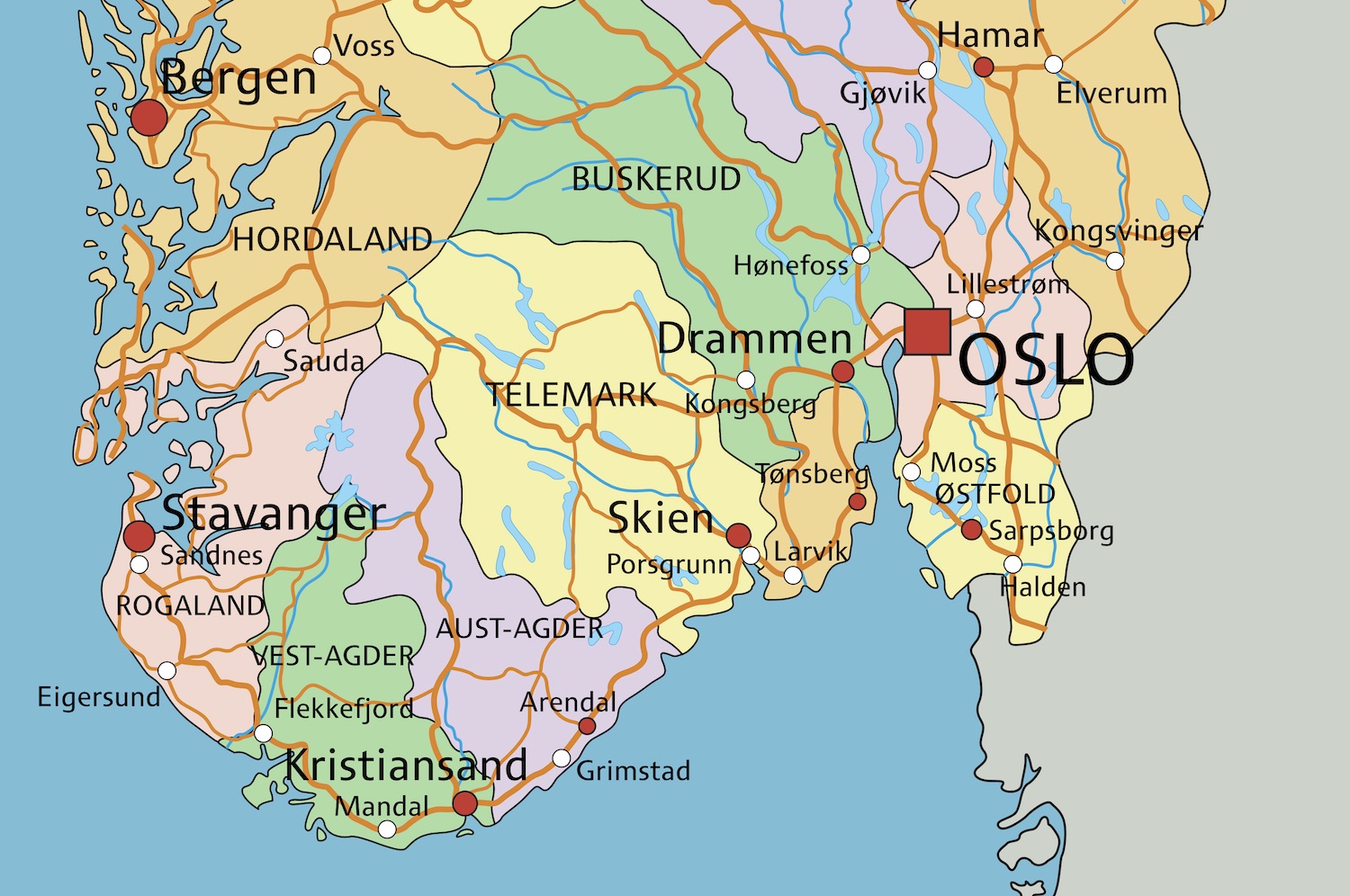
1. General Map of Norway (Counties, Cities & Main Roads)
A clear overview of Norway’s geography: county boundaries, major cities from Oslo to Tromsø, and the principal coastal and inland corridors you’ll drive most. Perfect to orient your itinerary before zooming into details.
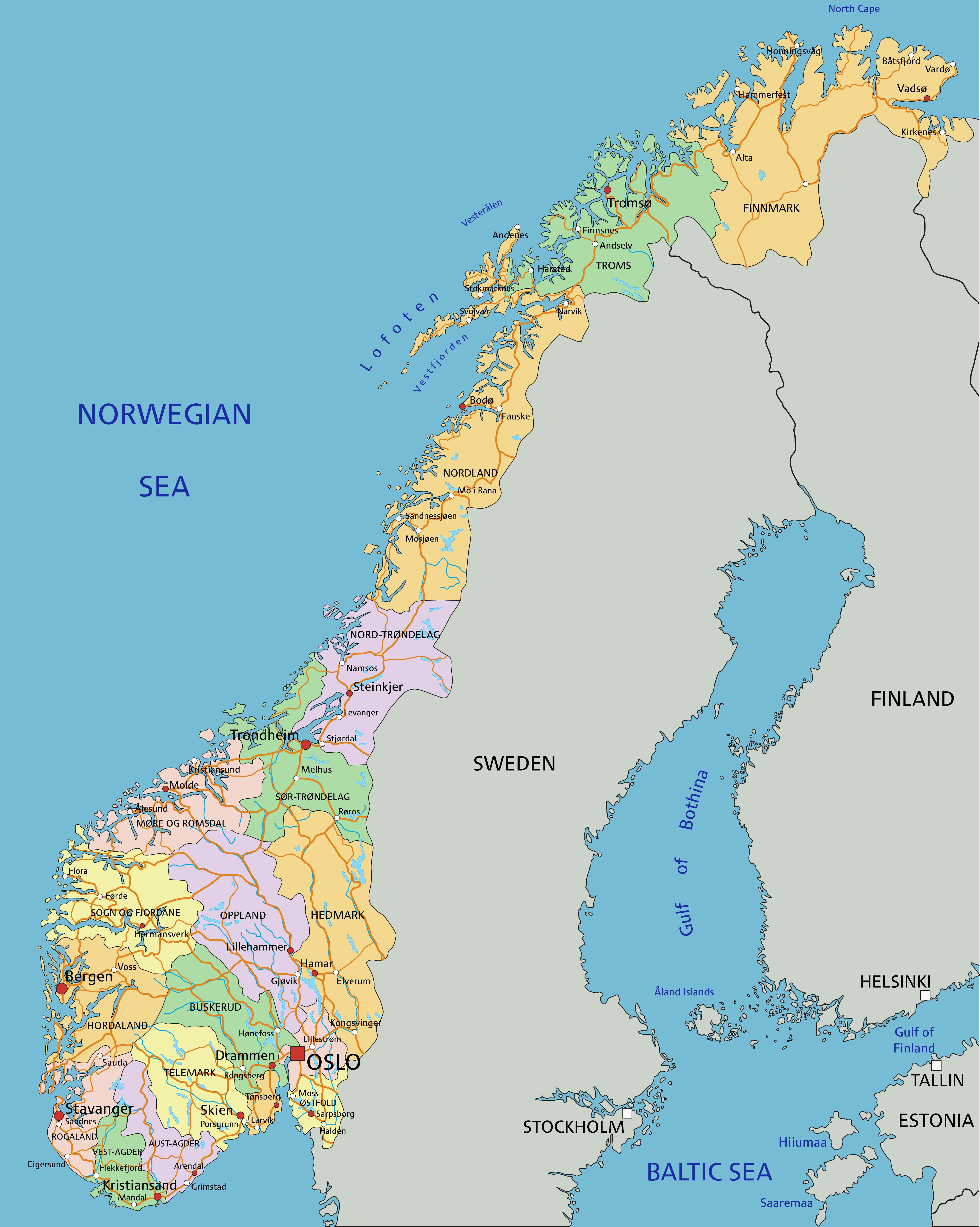
2. Norway Road Map
Source: Geoatlas.
The driving network at a glance—E-roads and national highways plus scenic secondary routes along fjords and mountain passes. Use it to estimate realistic drive times and pick weather-safe alternatives.
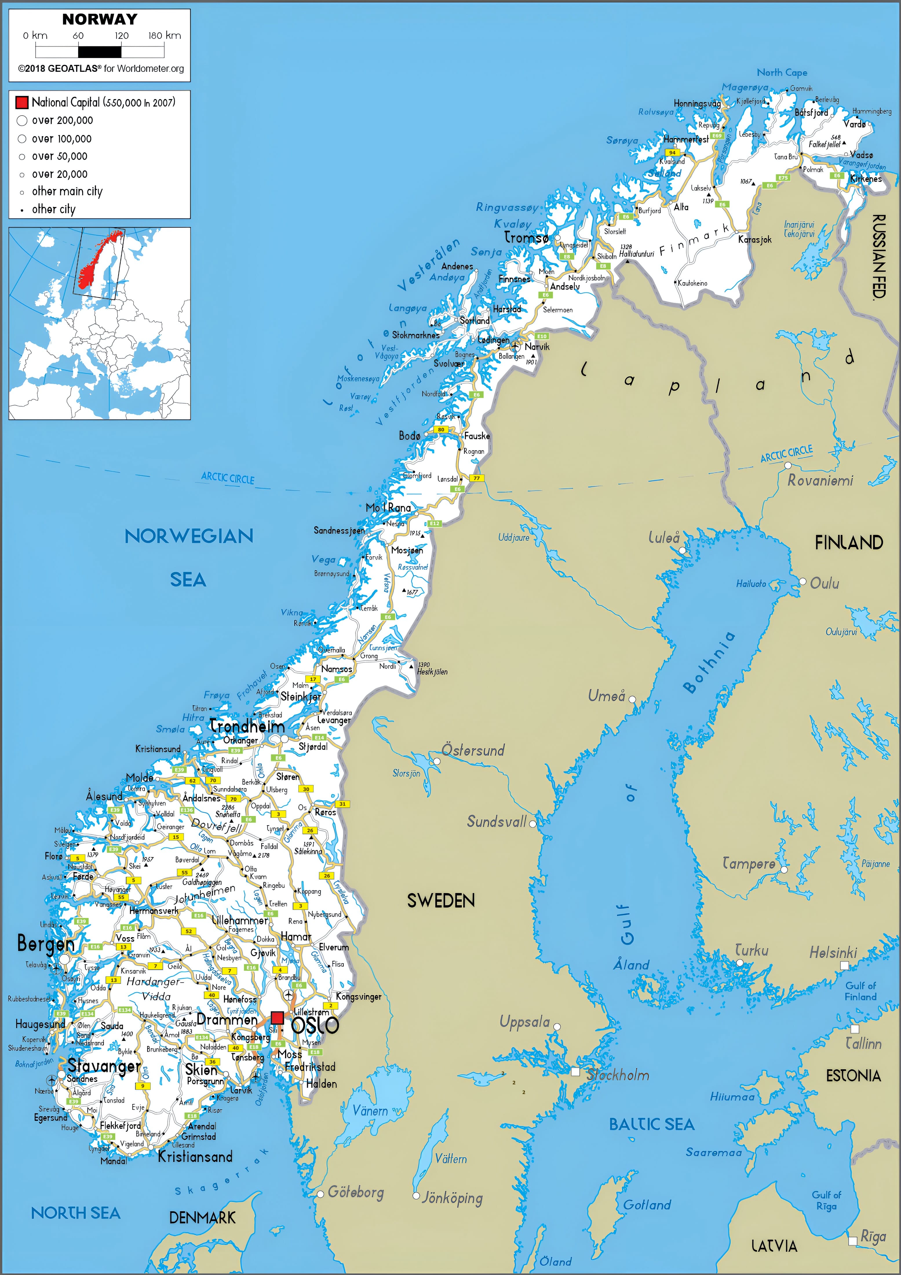
3. Norway Tourist Attractions Map (Interactive PDF)
Source: mytouristmaps.
Icons highlight headline sights—fjords, national parks, islands and key cities—from Lofoten to the fjord region. In the PDF, selected icons are clickable for extra details or official websites.
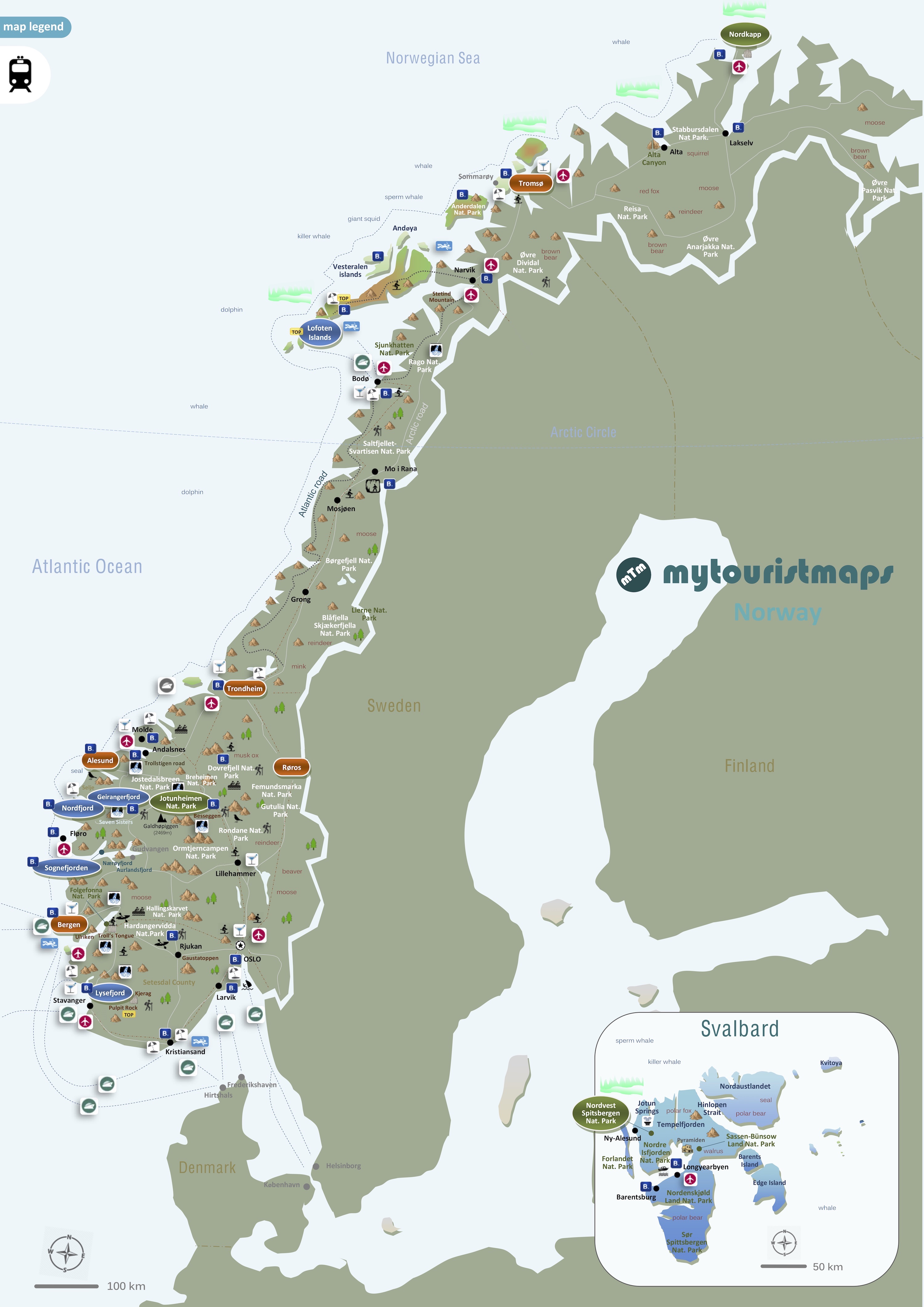
4. Norway Elevation Map (Relief)
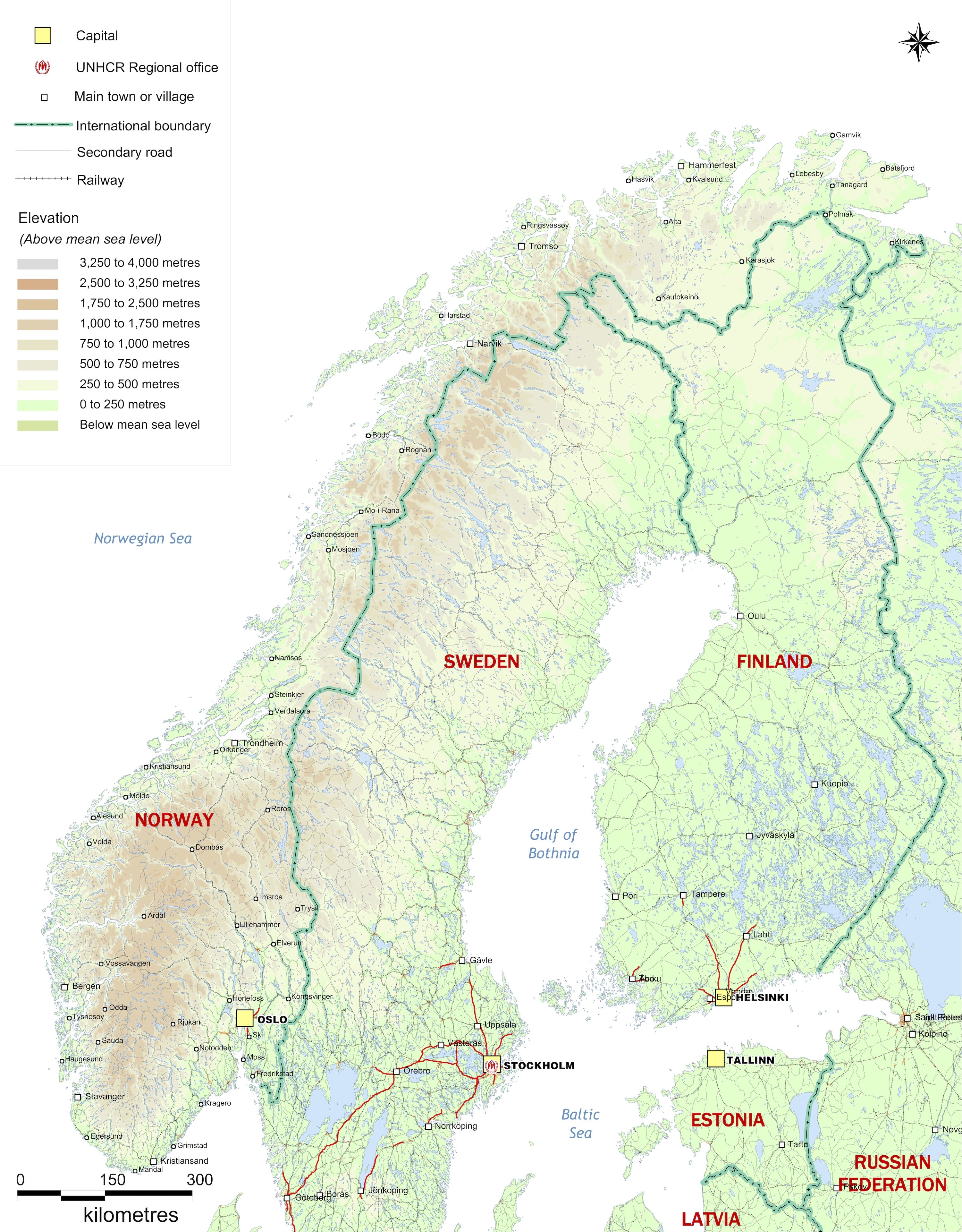
Source: UNHCR.
Colour bands show altitude from coastal lowlands to high plateaus, helping you anticipate gradients, weather shifts and where snow can linger at the edges of the season.